Forest Monitoring System Improvements Needed to Stop Conflict Palm Oil expansion in world-renowned Leuser Ecosystem
Despite the urgent need to protect the world’s last standing rainforests, deforestation outside government allocated concessions continues in Indonesia’s extraordinary Leuser Ecosystem. RAN’s investigators have once again documented illegal expansion into nationally protected areas in the Leuser Ecosystem in the district of Aceh Tamiang on the island of Sumatra. RAN first highlighted this deforestation hotspot in April 2022 when we exposed deforestation inside the Gunung Leuser National Park by a civil servant from Medan called Mr. Bukhary.
In recent months, more extensive forest clearance has been documented by Mr. Bukhary and another local actor called Mr. Jumady within the surrounding area. Despite this case being brought to the attention of major global brands, RAN has been able to document that a further 475 acres of forests were cleared in the indicative areas of Mr. Bukhary’s lands into 2024.
To our knowledge, there has been no government or supply chain interventions taken during this period to stop the destruction even though the district government of Aceh Tamiang has public commitments to end deforestation and PepsiCo, Unilever and others claim that collaborative forest monitoring systems are being used to identify and respond to deforestation across the district.
These investigations show that lowland rainforests of the Leuser Ecosystem are systematically being cleared to make way for palm oil plantations that will produce fruits that will ultimately find their way into the supply chains of major brands like Procter & Gamble, Mondelēz, Colgate Palmolive, Nissin Foods, Nestlé, PepsiCo and Unilever. A recent report by RAN shows that none of these brands have effective traceability systems that can be relied upon to keep deforestation-tainted Conflict Palm Oil out of their supply chains and consumer goods products.
In 2023, Aceh Tamiang has rightfully been celebrated as one of the districts in Aceh with the lowest rates of deforestation––due in part to positive impacts of jurisdictional programs that have been established and aim to achieve No Deforestation, No Peatland and No Exploitation practices across all actors in the district’s palm oil sector. RAN’s investigation shows that these efforts are not enough––more action is needed to stop palm oil driven deforestation in critically important lowland rainforests in Aceh Tamiang, including within the formally protected Gunung Leuser National Park. The park, in addition to being recognized as a UNESCO World Heritage Site, is the last stronghold essential for the continued survival of critically endangered wildlife species including Sumatran orangutans, Sumatran tigers, and Sumatran elephants.
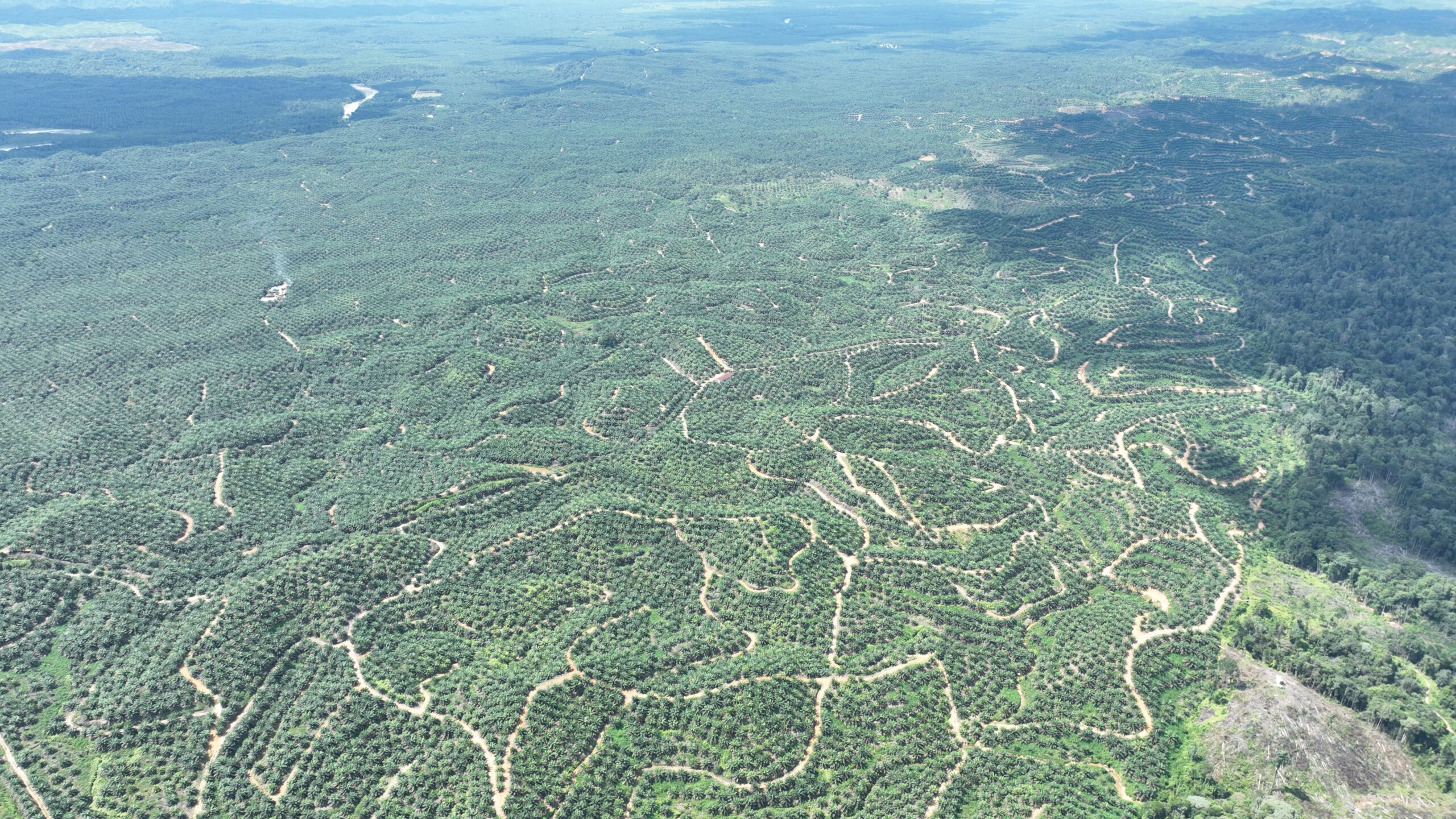
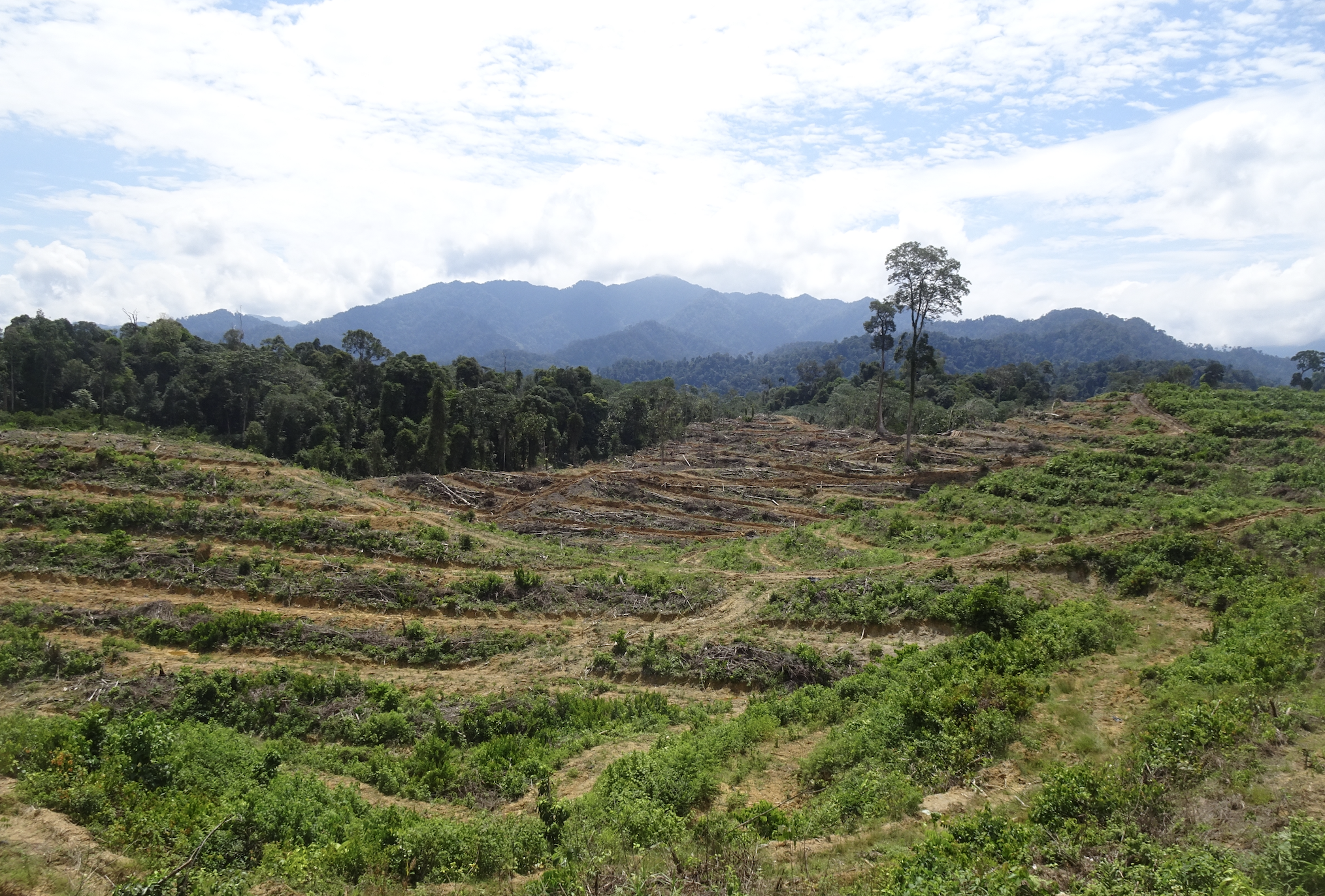
While the pattern of deforestation documented here is smaller than the scale witnessed over the past few decades of industrial palm oil expansion within government-allocated concessions across Indonesia, it remains deeply concerning as the primary remaining threat to the remaining lowland forests of the Leuser is a ‘death by a thousand cuts.’ In an increasing number of cases, this pattern of small-scale deforestation outside concessions is wrongly cited by actors in the palm oil industry as the impact of smallholder farmers clearing forests to establish family-managed palm oil farms. RAN’s investigations have shown that the deforestation outside concessions is significant, forests are being cleared through the use of expensive machinery, and is ultimately driven by land speculators – local elites that have the resources and influence needed to get away with deforestation and plantation establishment within protected areas. Despite industry efforts to shift blame, the culprits of this new wave of destruction are local elites – not smallholder family farmers that are increasingly being supported to achieve certification for their family plots of palm oil farms located outside the Gunung Leuser National Park in the surrounding villages.
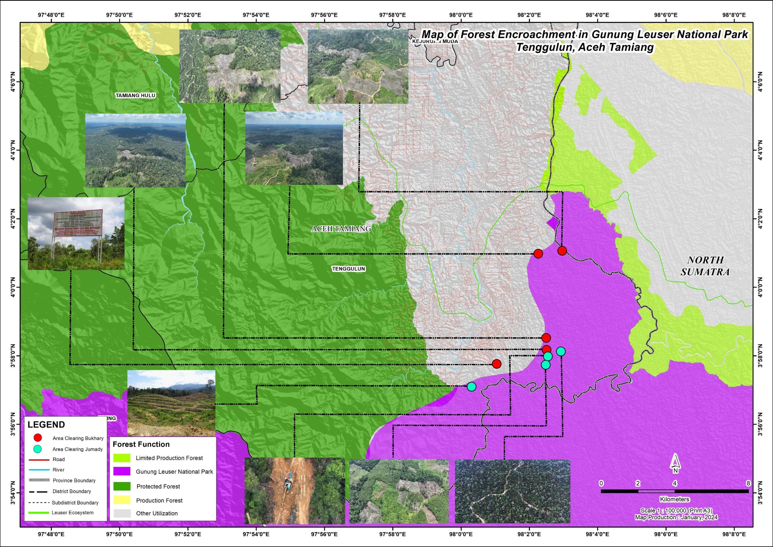
In this investigation, one of these local elites exposed is Mr. Bukhary ––a Medan based retired civil servant and the other is known locally as Mr. Jumady. The images below show the destruction documented in recent months in two main areas near Tenggulun village in the district of Aceh Tamiang. The deforestation hotspot caused by Mr. Bukhary is shown below in the northern tip of the Gunung Leuser National Park (purple area). The red dots show the locations of recent clearing. The blue dots towards the bottom of the map show the locations where RAN’s investigators documented recent logging and clearance within the Gunung Leuser National Park by Mr. Jumady.
Ongoing deforestation by Mr Bukhary inside Gunung Leuser National Park
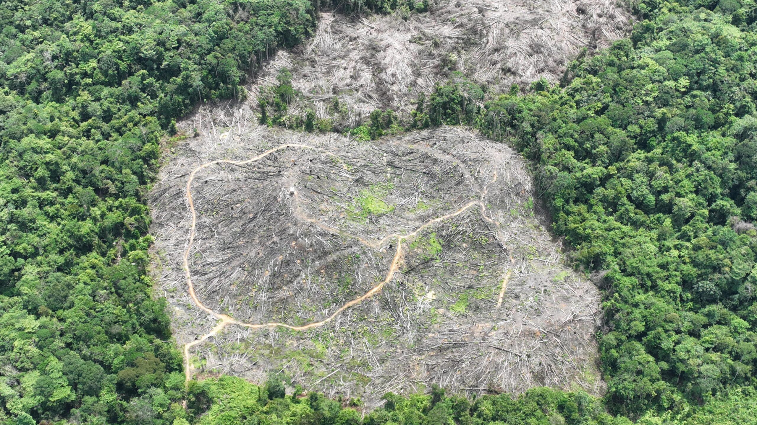
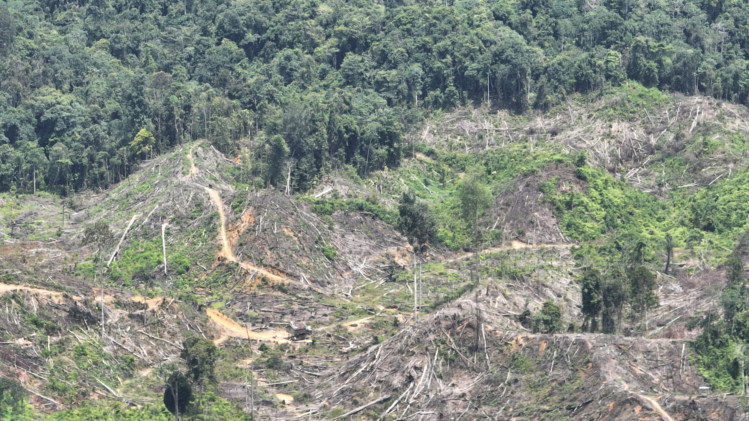
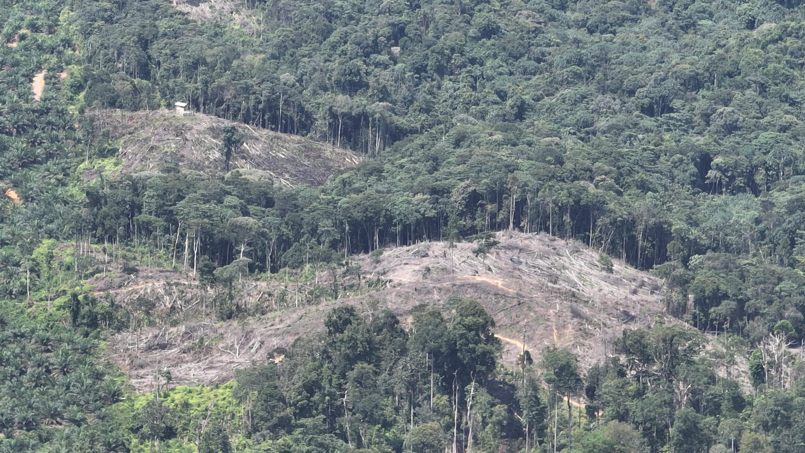
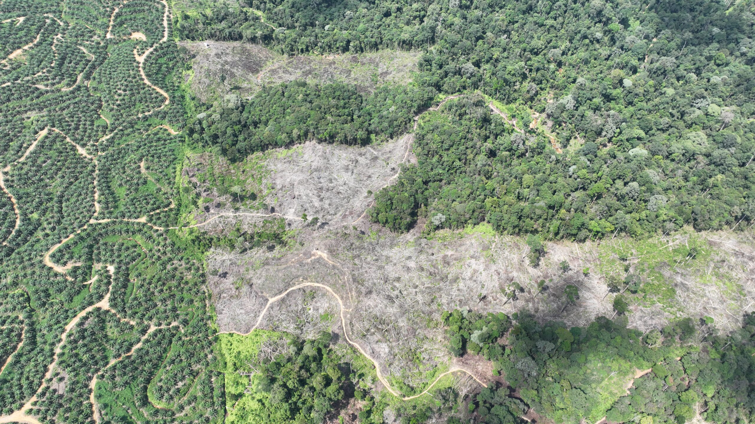
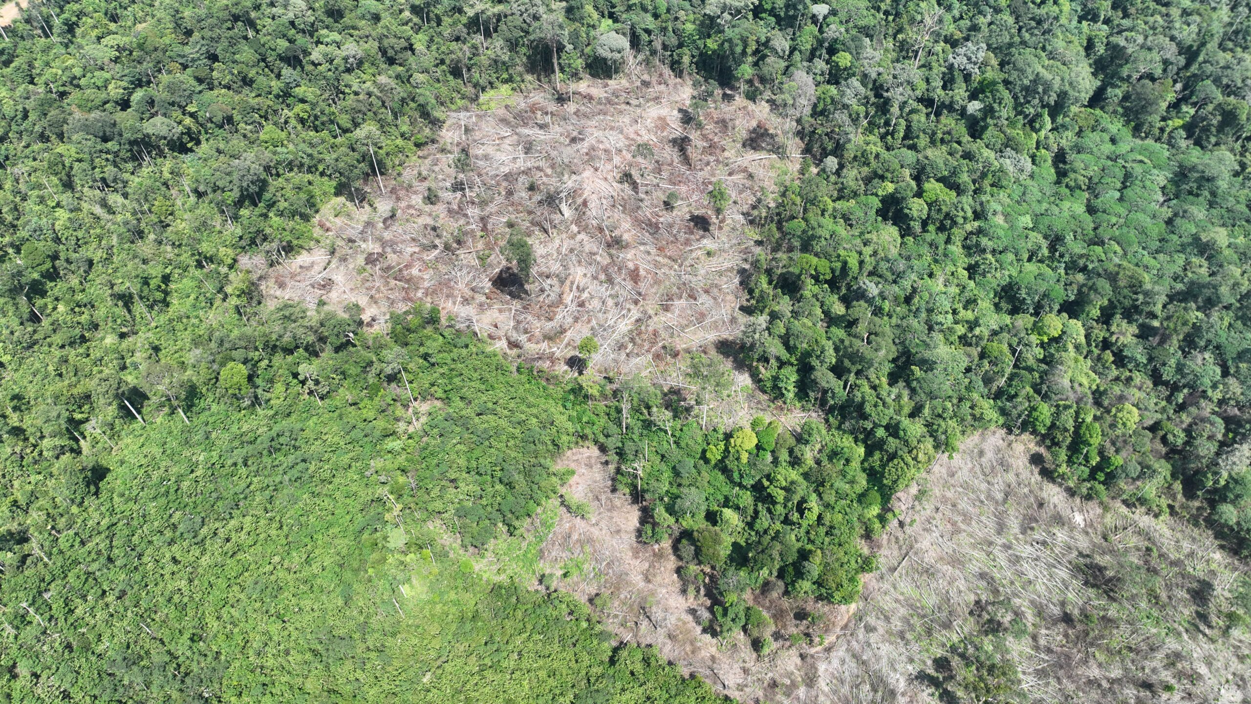
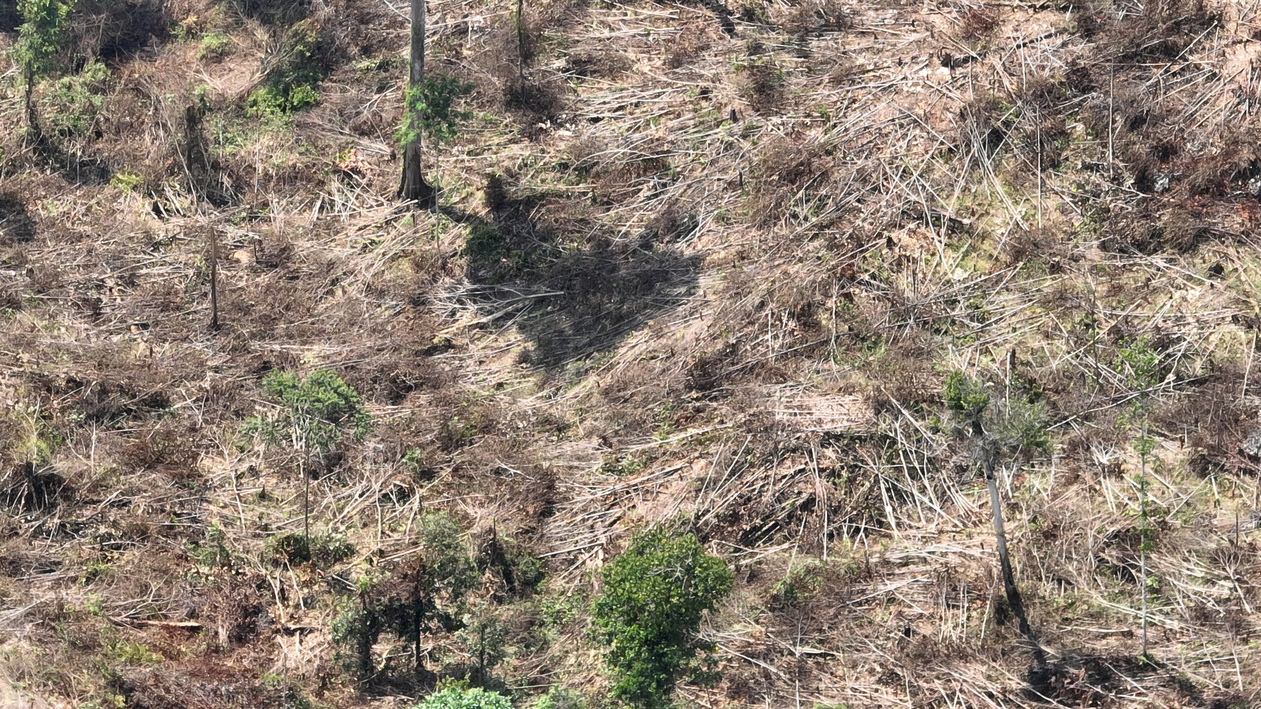
The images below show the scale of ongoing deforestation by Mr. Bukhary inside the Gunung Leuser National Park, near Tenggulun village in the district of Aceh Tamiang. The lowland rainforests of the Leuser Ecosystem are systematically being cleared by Mr. Bukhary, who hopes to sell his palm oil to nearby mills that supply major palm oil traders like Apical of the Royal Golden Eagle Group, Musim Mas, Golden-Agri Resources and Wilmar. These traders are the main suppliers to global brands including Procter & Gamble, Mondelēz, Colgate Palmolive, Nissin Foods, Nestlé, PepsiCo and Unilever.
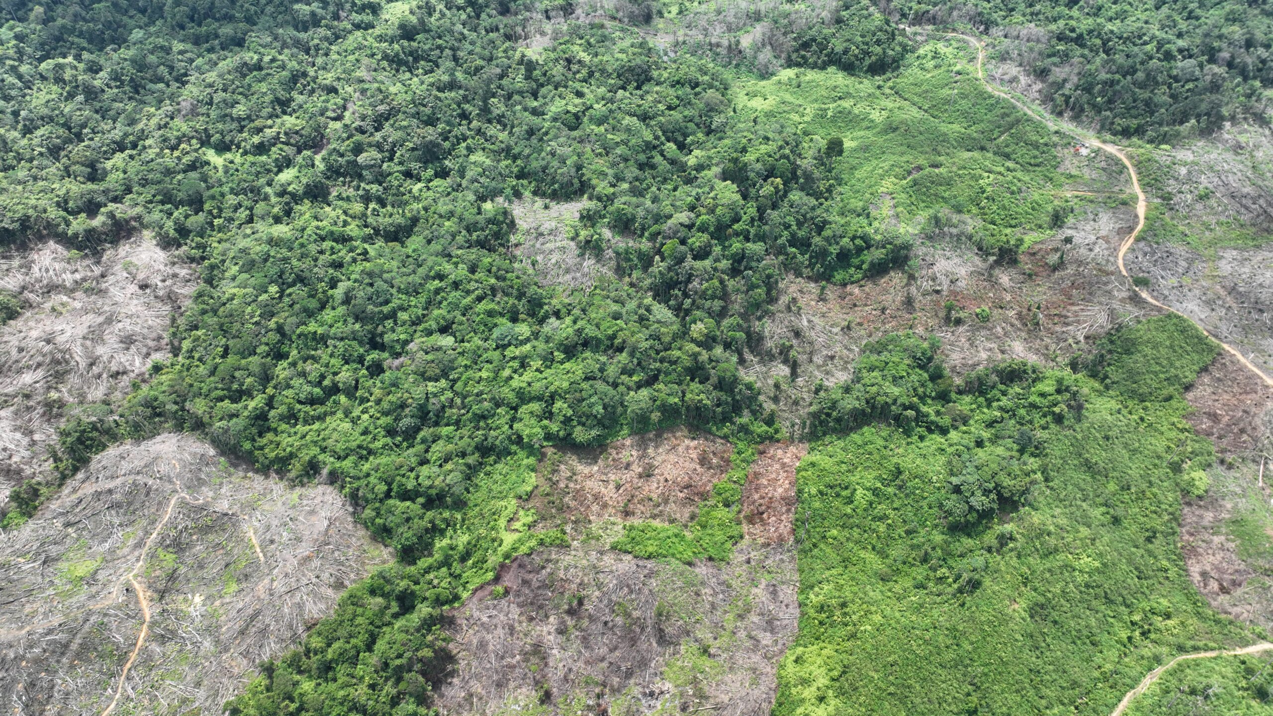
Deforestation by Mr. Bukhary GPS Coordinates 04°01’03.72″N 98°02’57.64″E
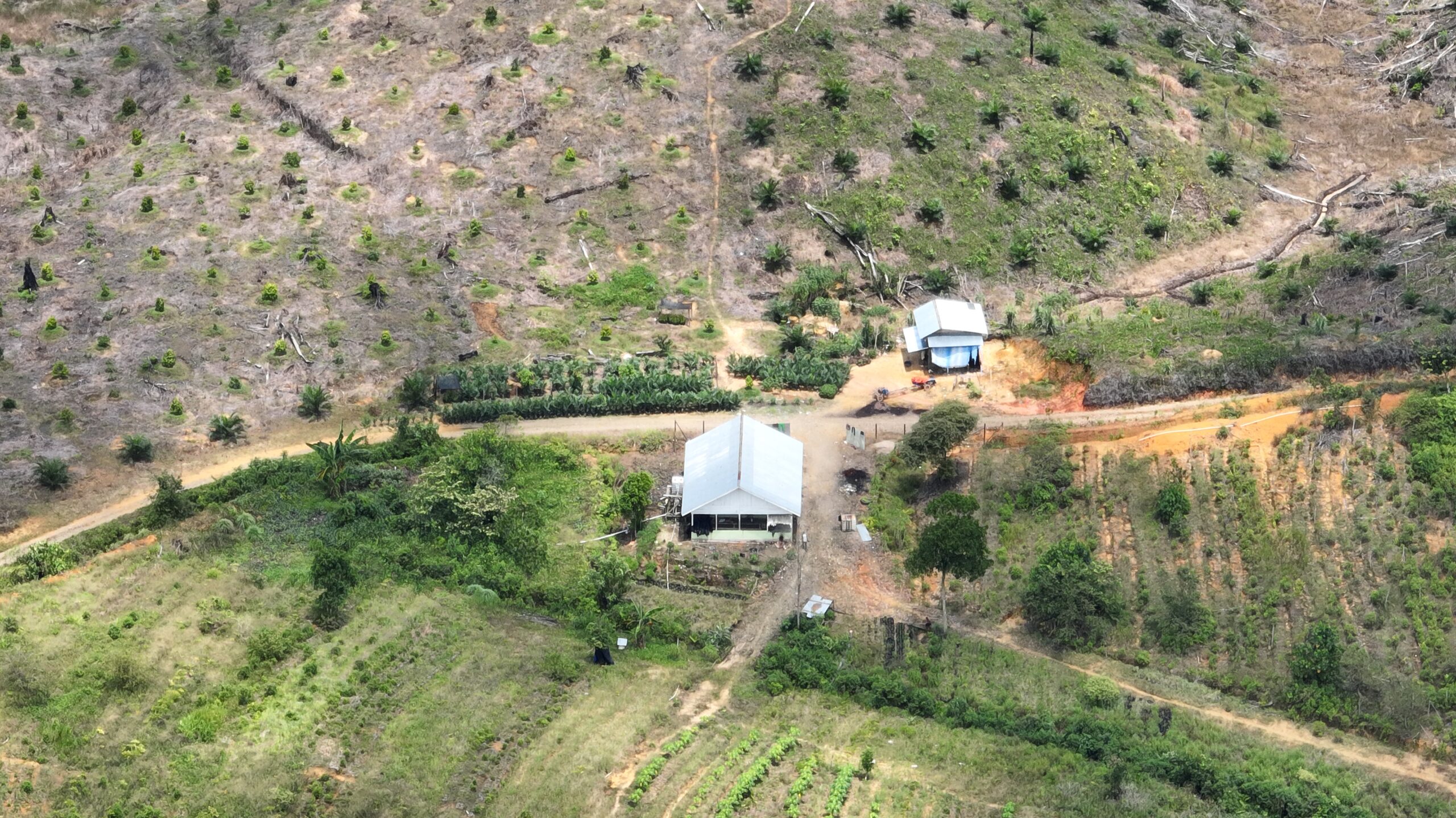
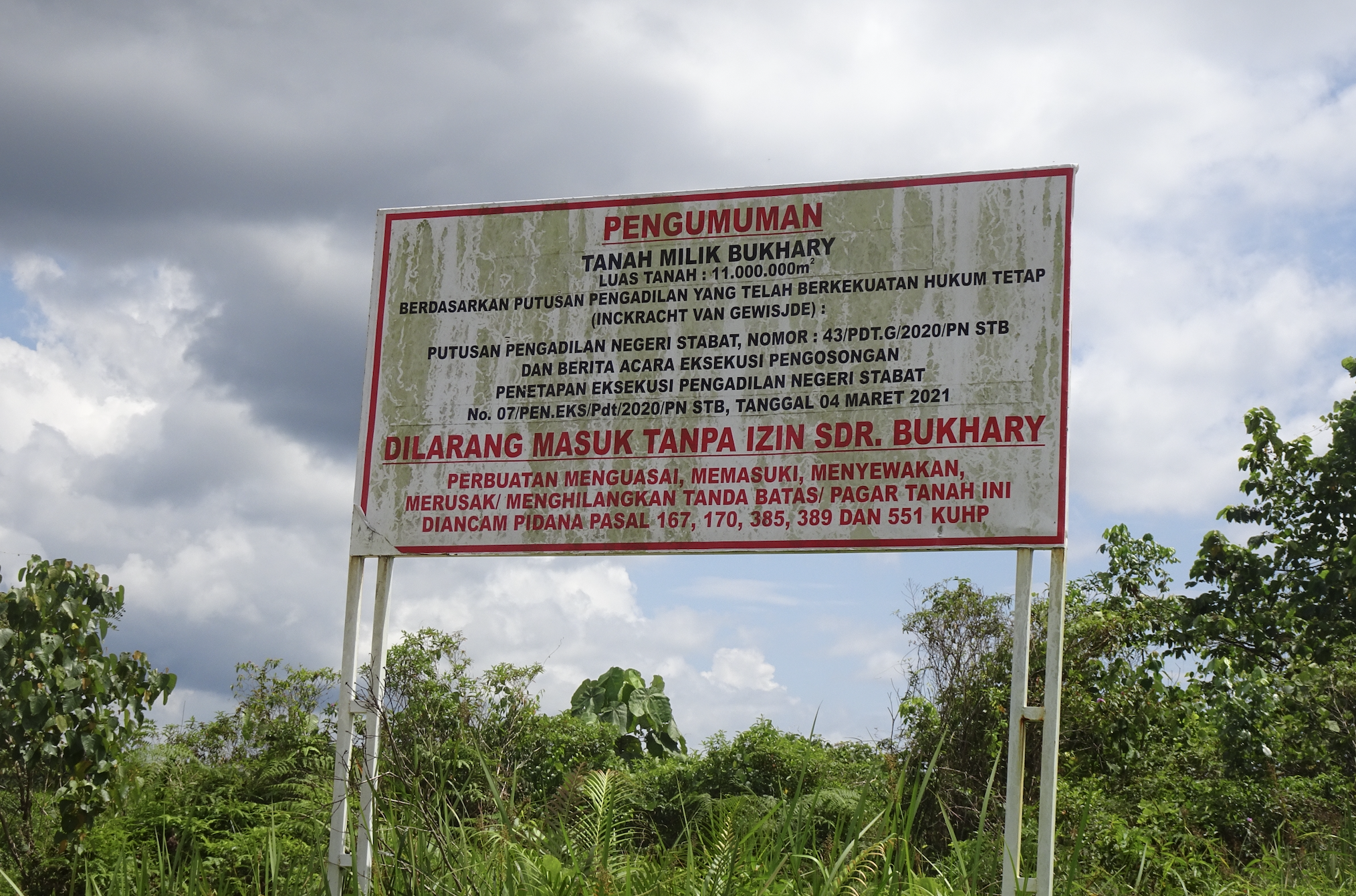
A sign erected by Mr. Bukhary, claiming ownership rights. GPS Coordinates: 03°57’45.61″N 98°01’02.72″E
In March 2021, Mr. Bukhary erected a sign claiming his legal ownership rights to land after a district court decision affirmed his claims to ownership of the land. The land now controlled by Mr. Bukhary includes lands that were once forests inside the boundaries of the Gunung Leuser National Park. The steps through which Mr. Bukhary gained permission to convert lands that were formerly within a protected area are unclear––as this activity is prohibited under Indonesian law unless exceptions are granted by the Minister for Environment and Forestry. The lands claimed by Mr. Bukhary were formerly part of the neighboring district of Langkat, in the province of North Sumatra, so exceptions may have been granted by district and provincial governments of North Sumatra.
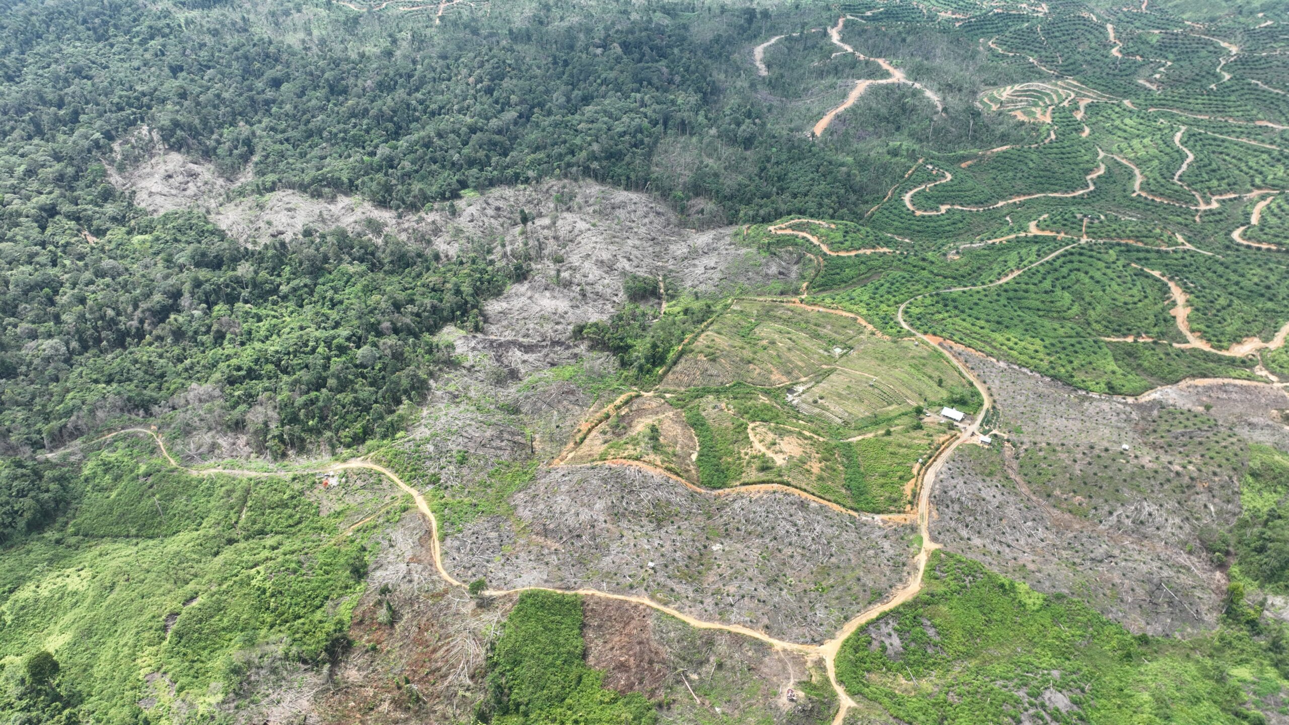
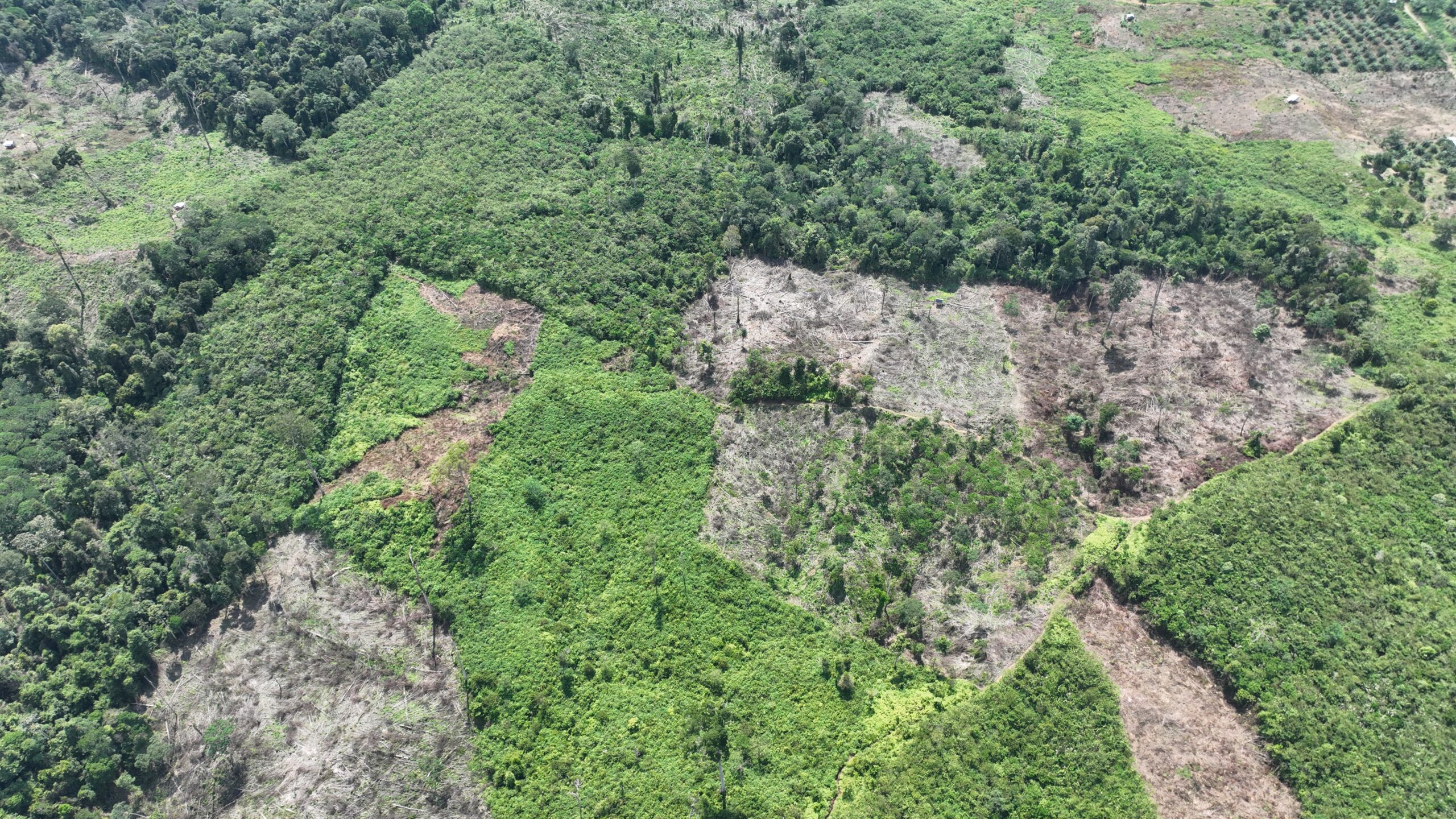
Between March 2021 and RAN’s April 2022 expose,150 acres were cleared and significant deforestation has continued since then as well as throughout 2023. A further 475 acres of forests were cleared in the indicative areas of Mr Bukary’s lands in 2023. The maps below show the areas cleared throughout June to December 2023:
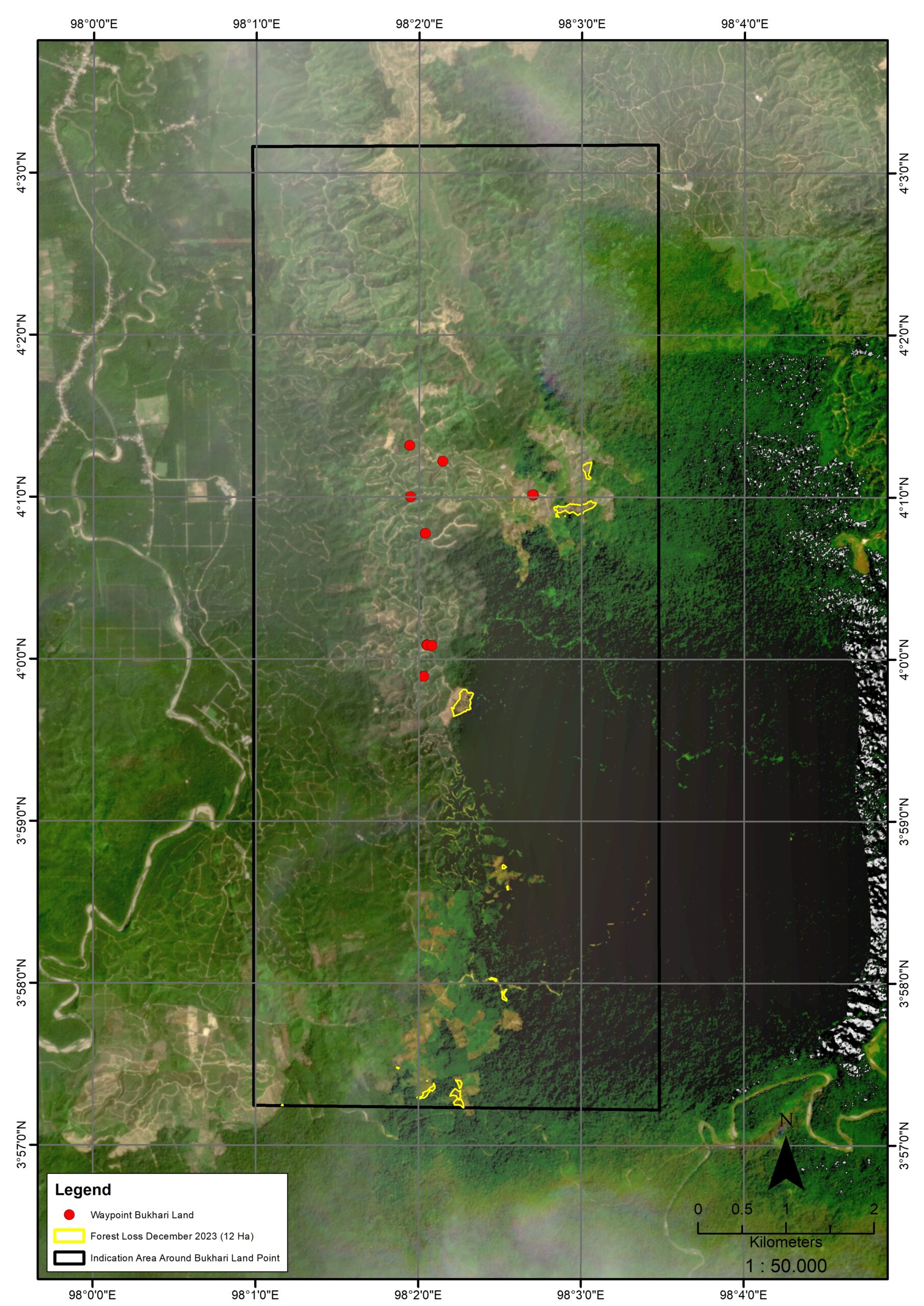
Satellite map showing forest loss in the indicative area of Mr. Bukhary’s palm oil plantation, December 2023

Satellite map showing forest loss in the indicative area of Mr. Bukhary’s palm oil plantation, November 2023
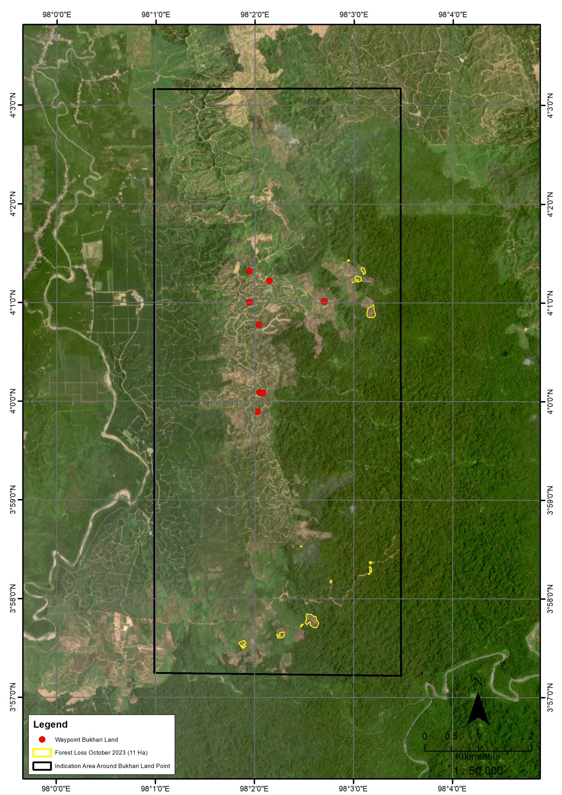
Satellite map showing forest loss in the indicative area of Mr. Bukhary’s palm oil plantation, October 2023
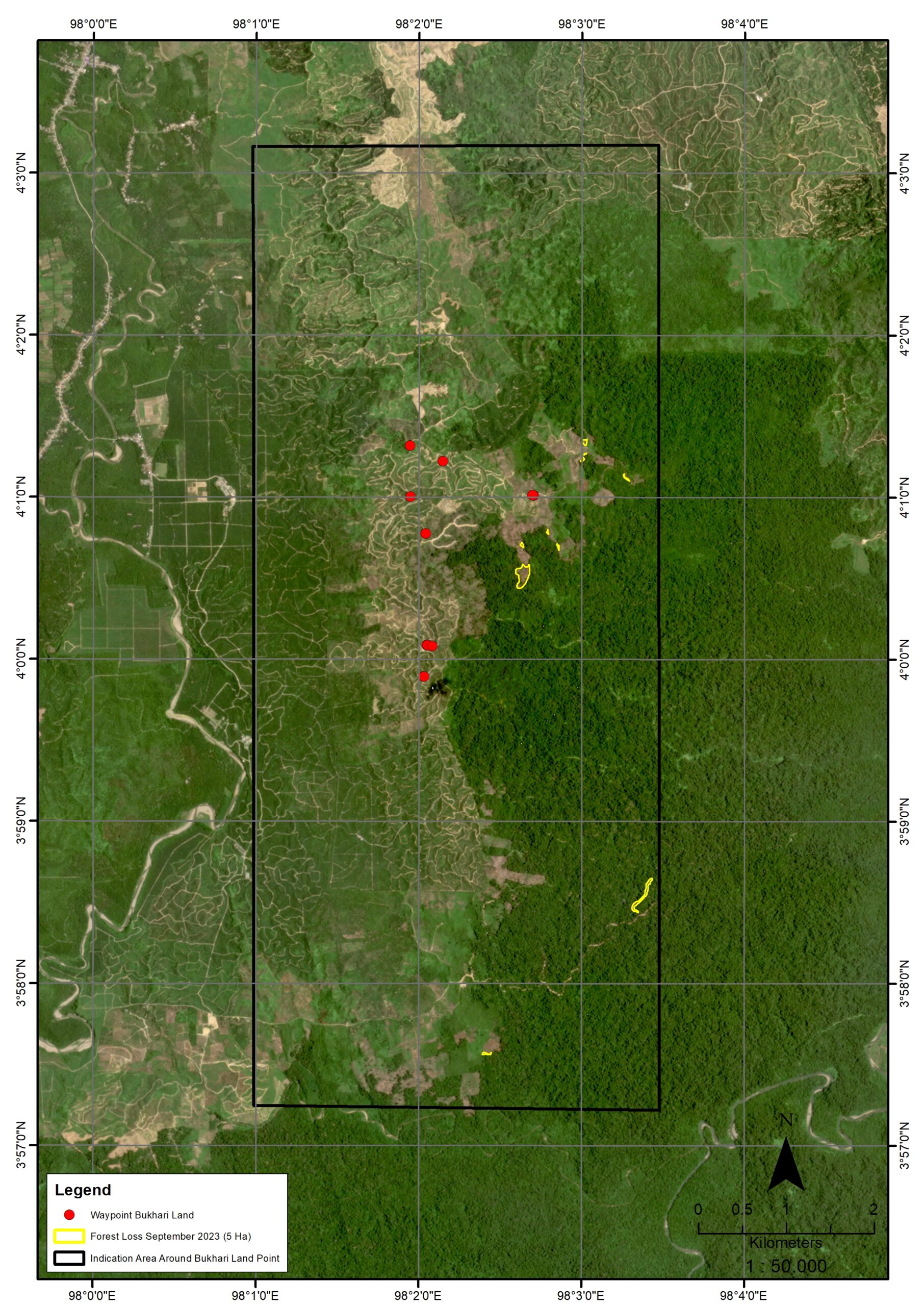
Satellite map showing forest loss in the indicative area of Mr. Bukhary’s palm oil plantation, September 2023
Satellite map showing forest loss in the indicative area of Mr. Bukhary’s palm oil plantation, August 2023
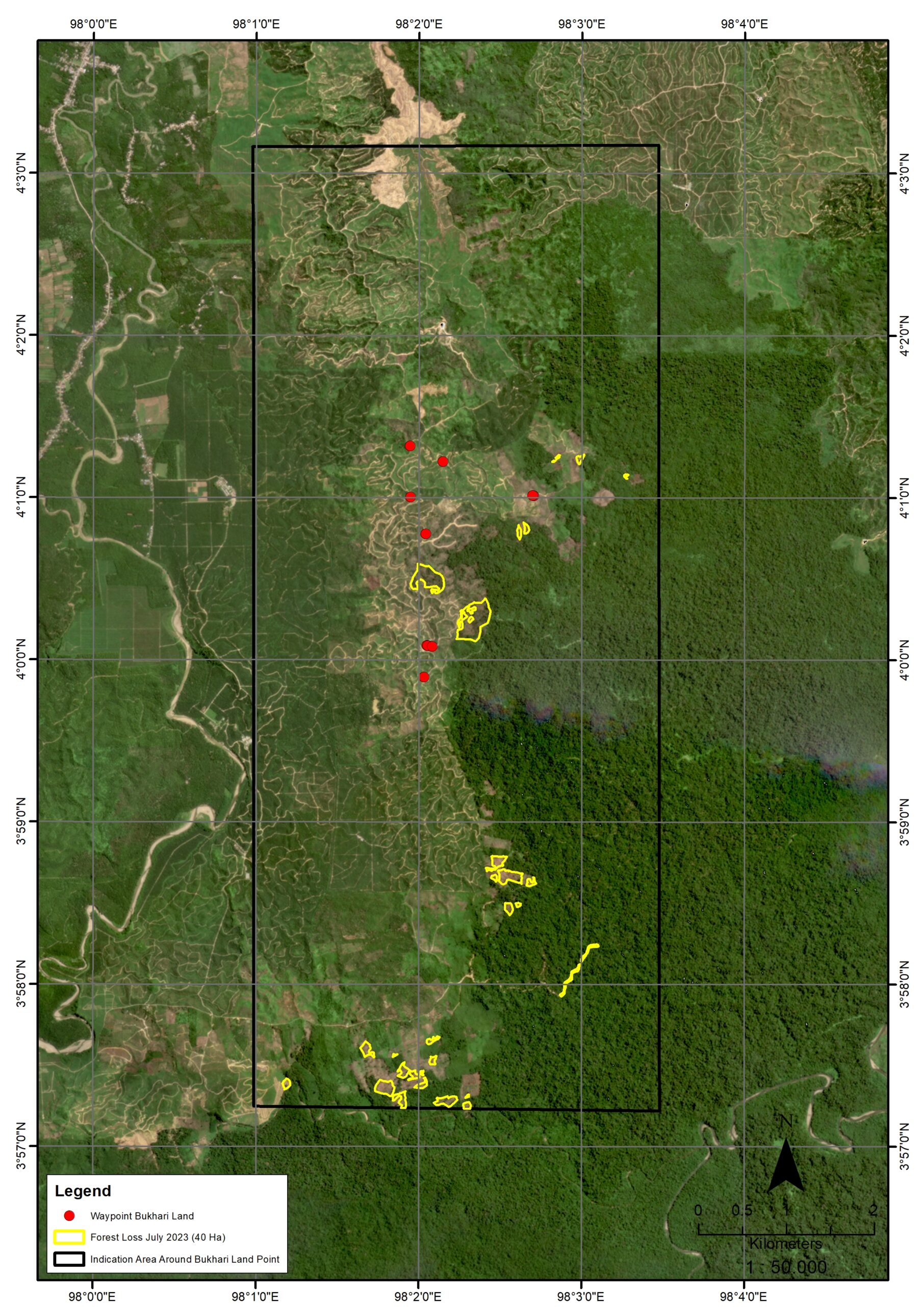
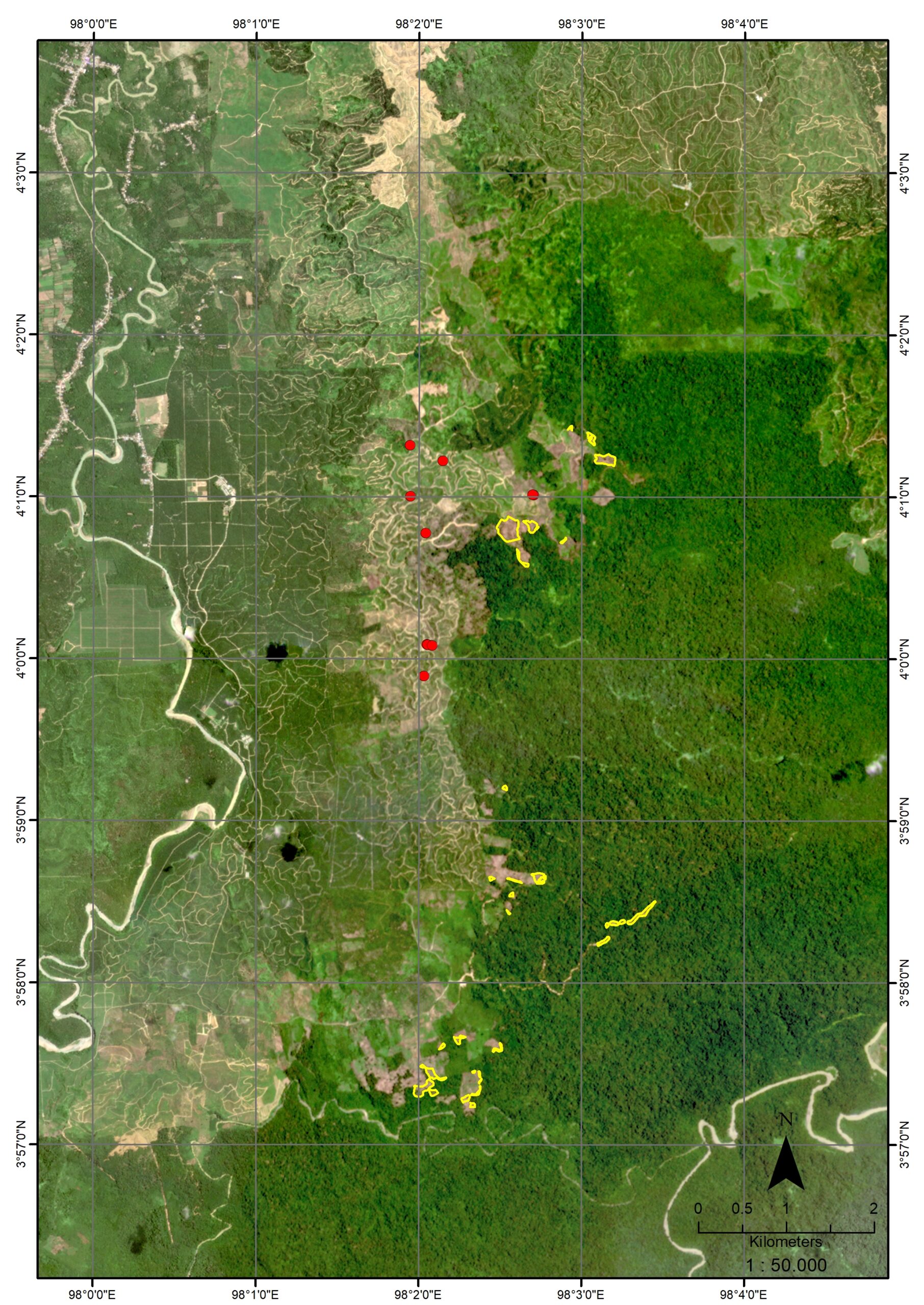
Satellite map showing forest loss in the indicative area of Mr. Bukhary’s palm oil plantation, July 2023
![]()
Satellite map showing forest loss in the indicative area of Mr. Bukhary’s palm oil plantation, June 2023. Satellite analysis shows forest clearance persists in early 2024.
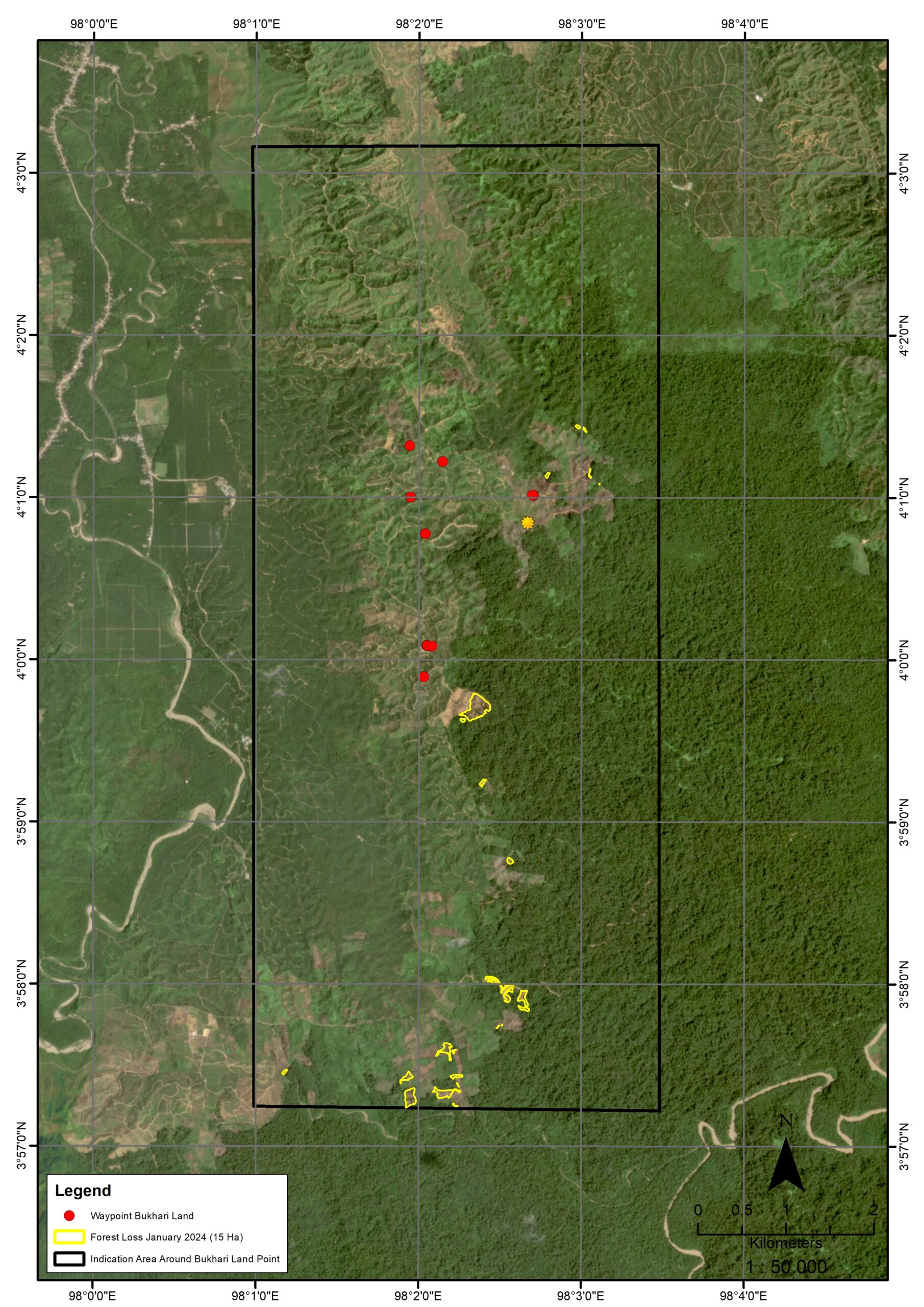
Satellite map showing forest loss in the indicative area of Mr. Bukhary’s palm oil plantation, Jan 2024.
Mr. Bukhary’s ownership rights remain contested. In 2022, following the issuance of the district court decision, conflicts continued to re-emerge with residents whose lands overlap with those claimed by Mr. Bukhary. Residents from the Adil Makmur II, Tenggulun Village and the Independent Swakarsa Forest Farmers Group continue to challenge the decision of the district court. The conflict between these parties persisted for over a year and reached a climax when the police arrested three residents of the village.
Illegal logging and deforestation by Mr. Jumady inside Gunung Leuser National Park
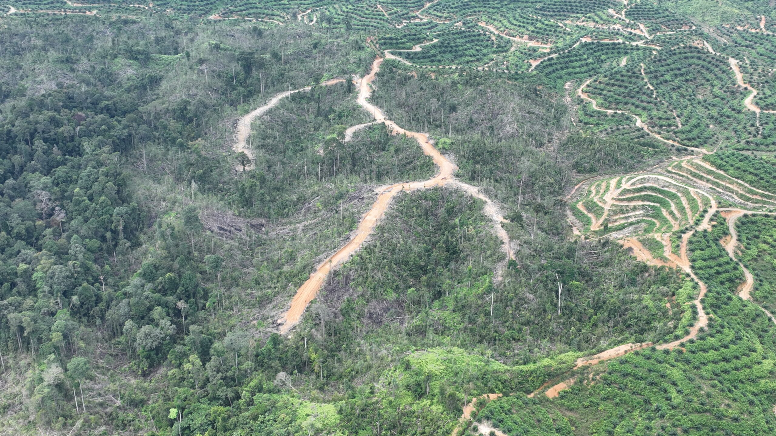
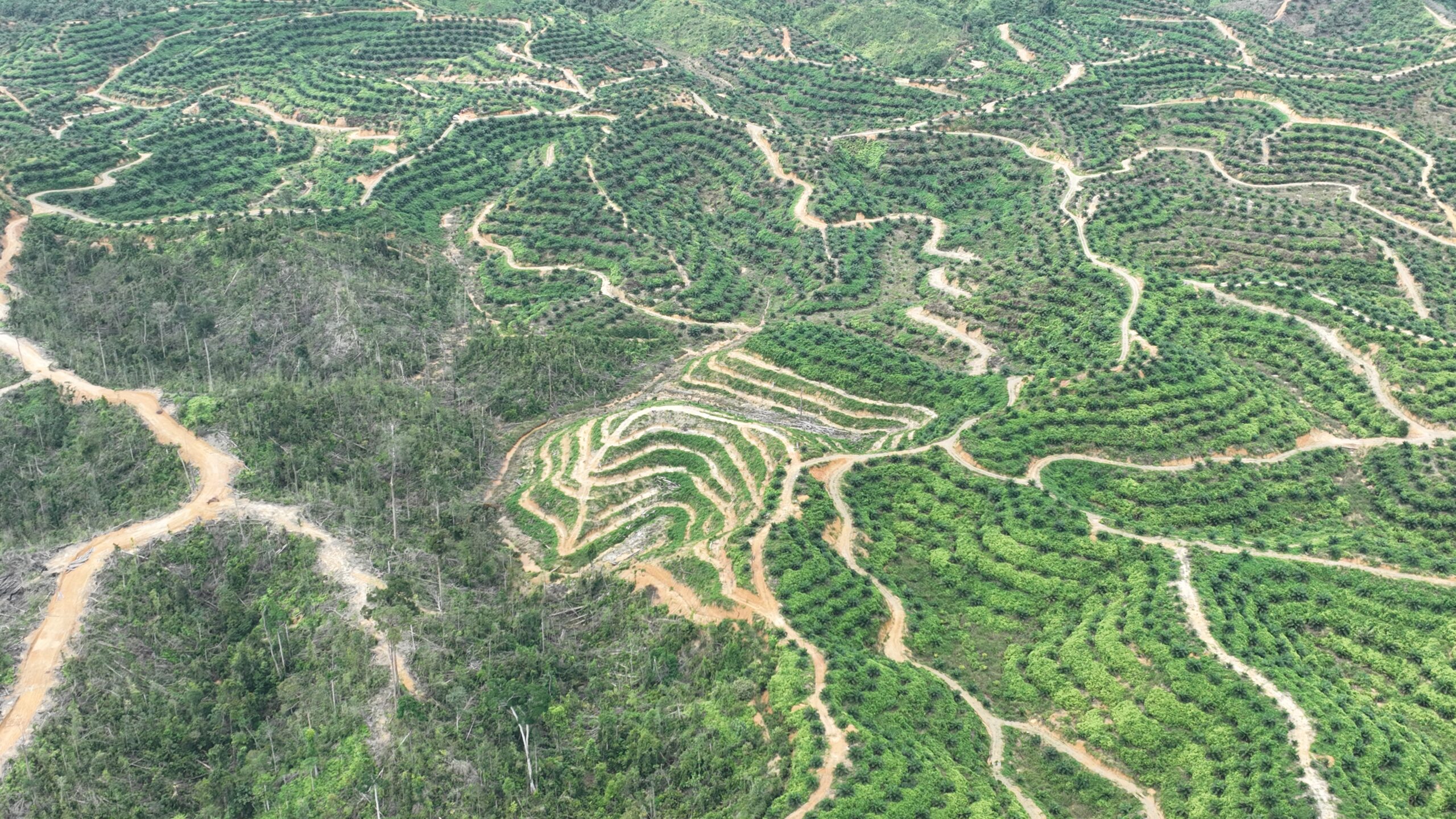
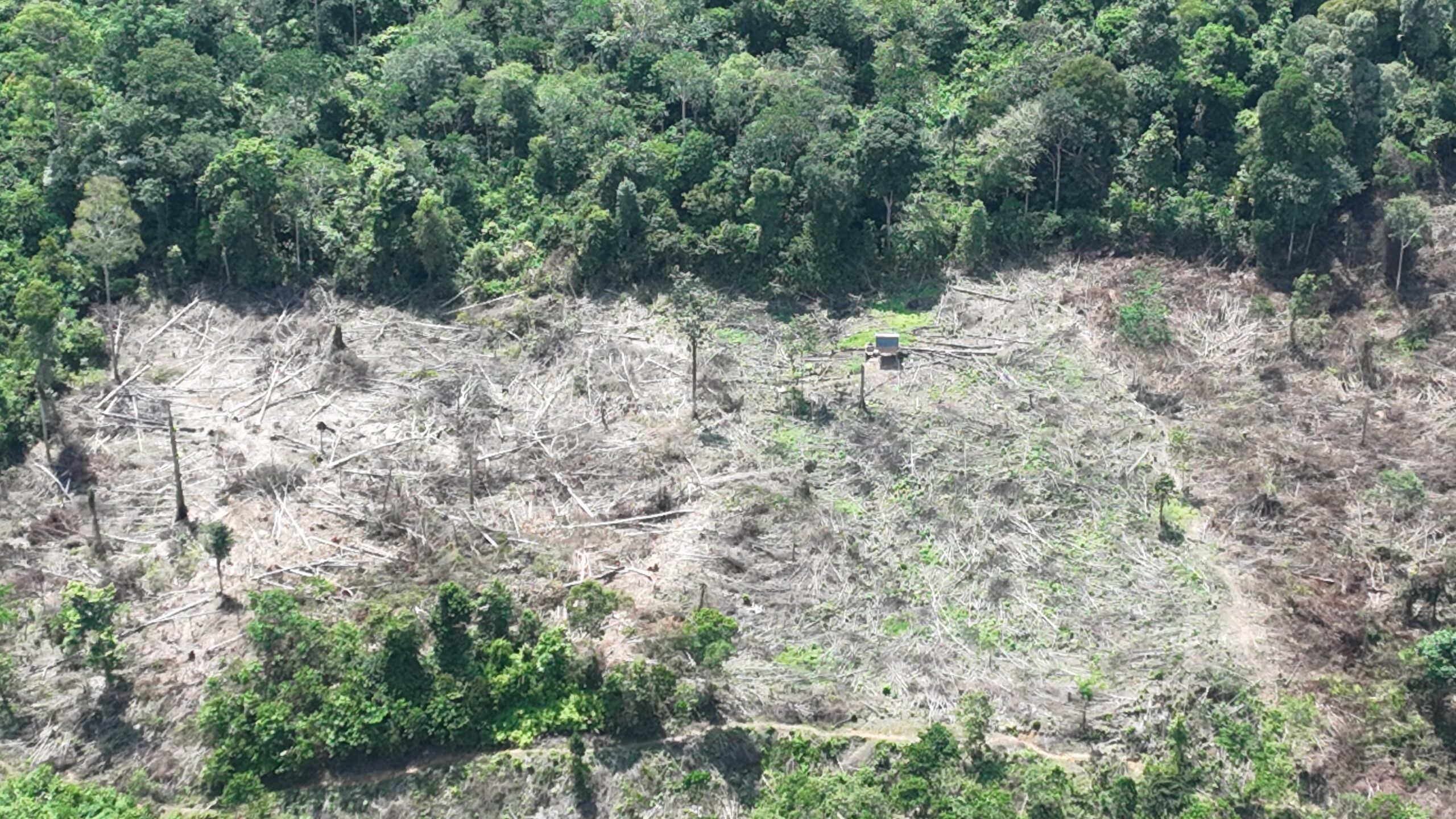
The images below show the scale of new road development and deforestation by Mr. Jumady inside the Gunung Leuser National Park, near Tenggulun village in the district of Aceh Tamiang. Illegal logging is also rampant in the area.
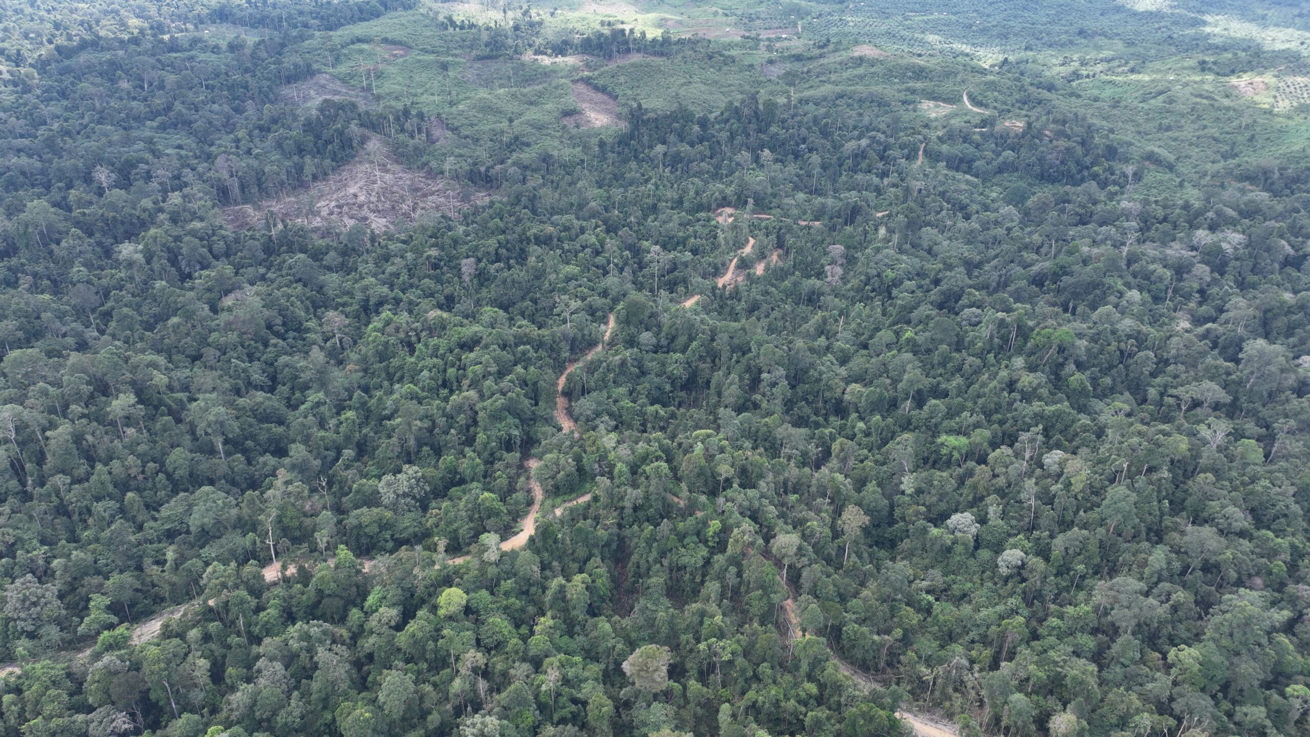
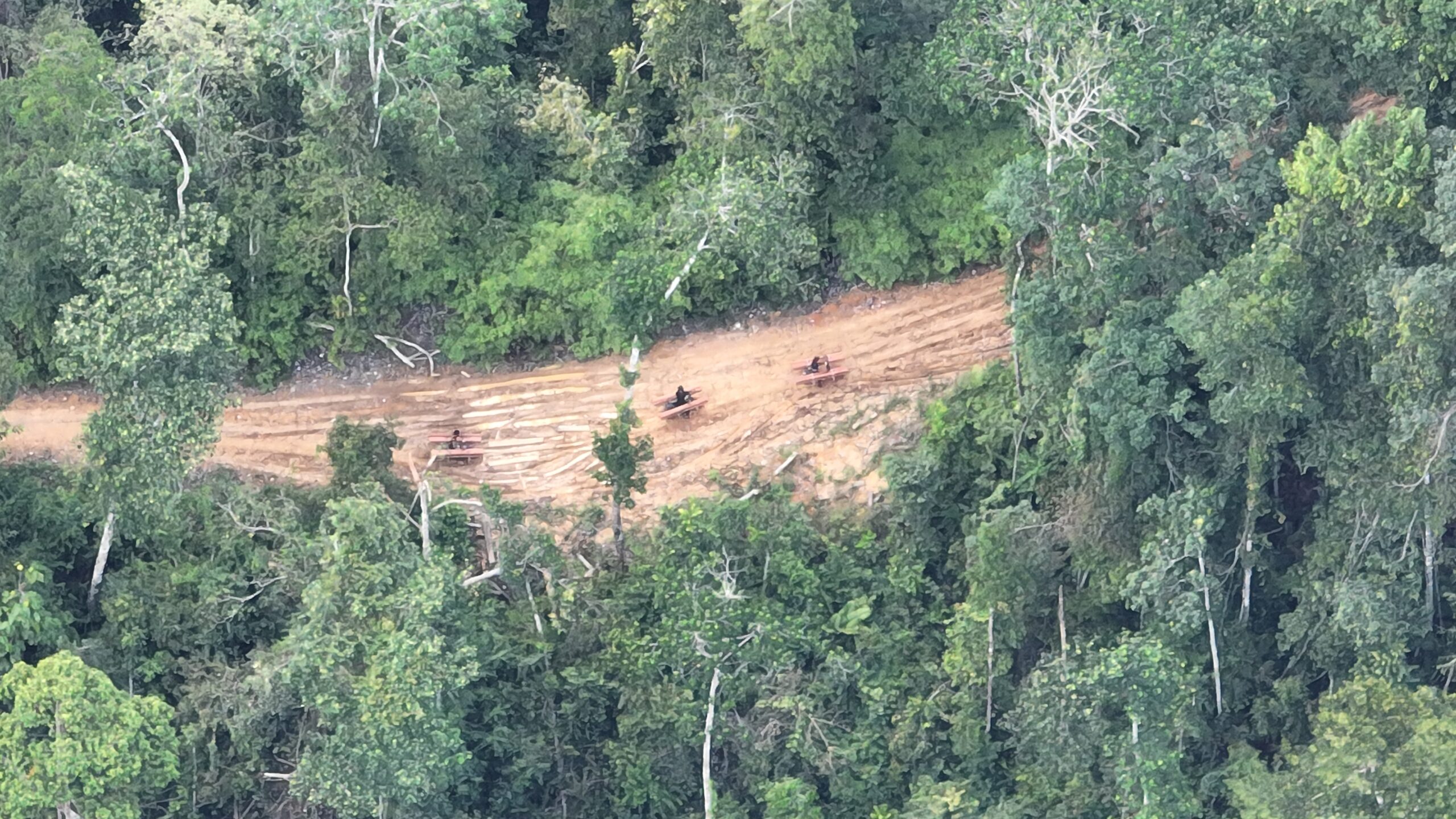
Piles of logs from illegal logging operations within protected forests. The forests are being logged and cleared to make way for palm oil plantations GPS Coordinates 03°57’05.89″N 98°00’15.40″E
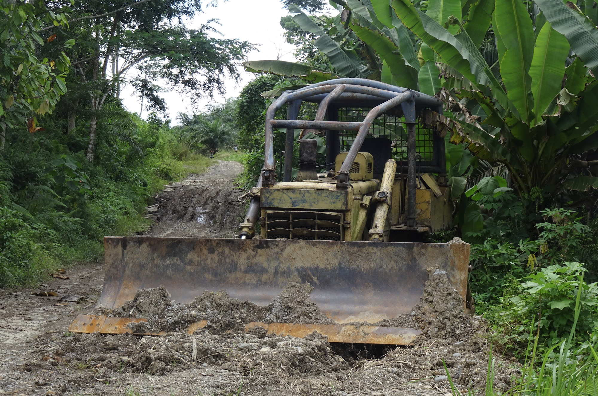
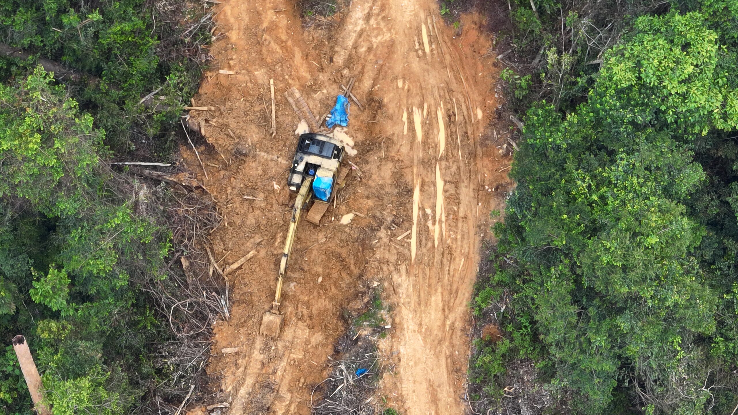
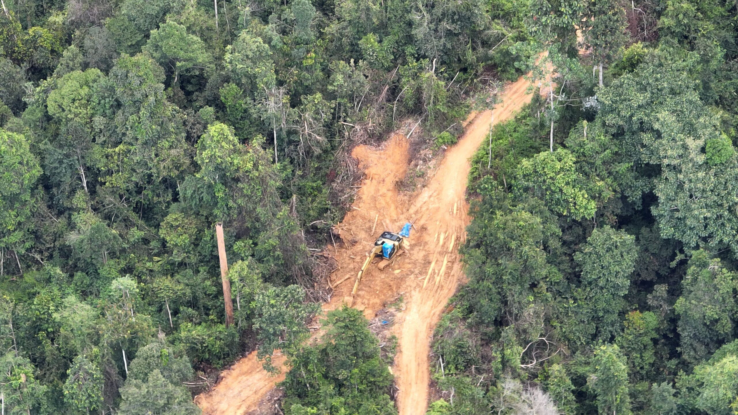
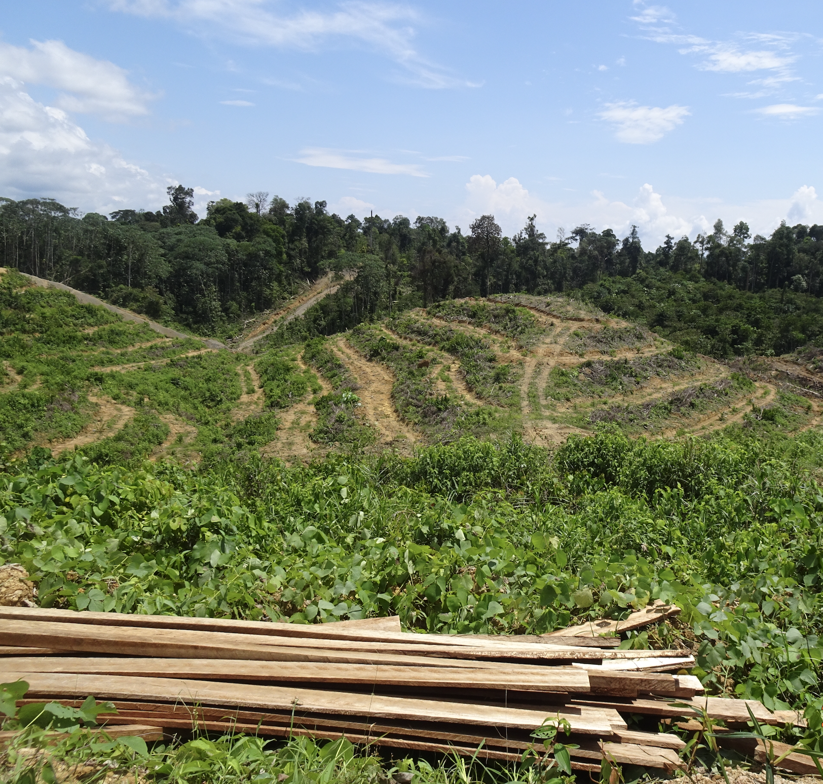
Mr. Jumady’s excavator used to clear forests for palm oil GPS Coordinates 03°57’46.91″N 98°01’45.11″E
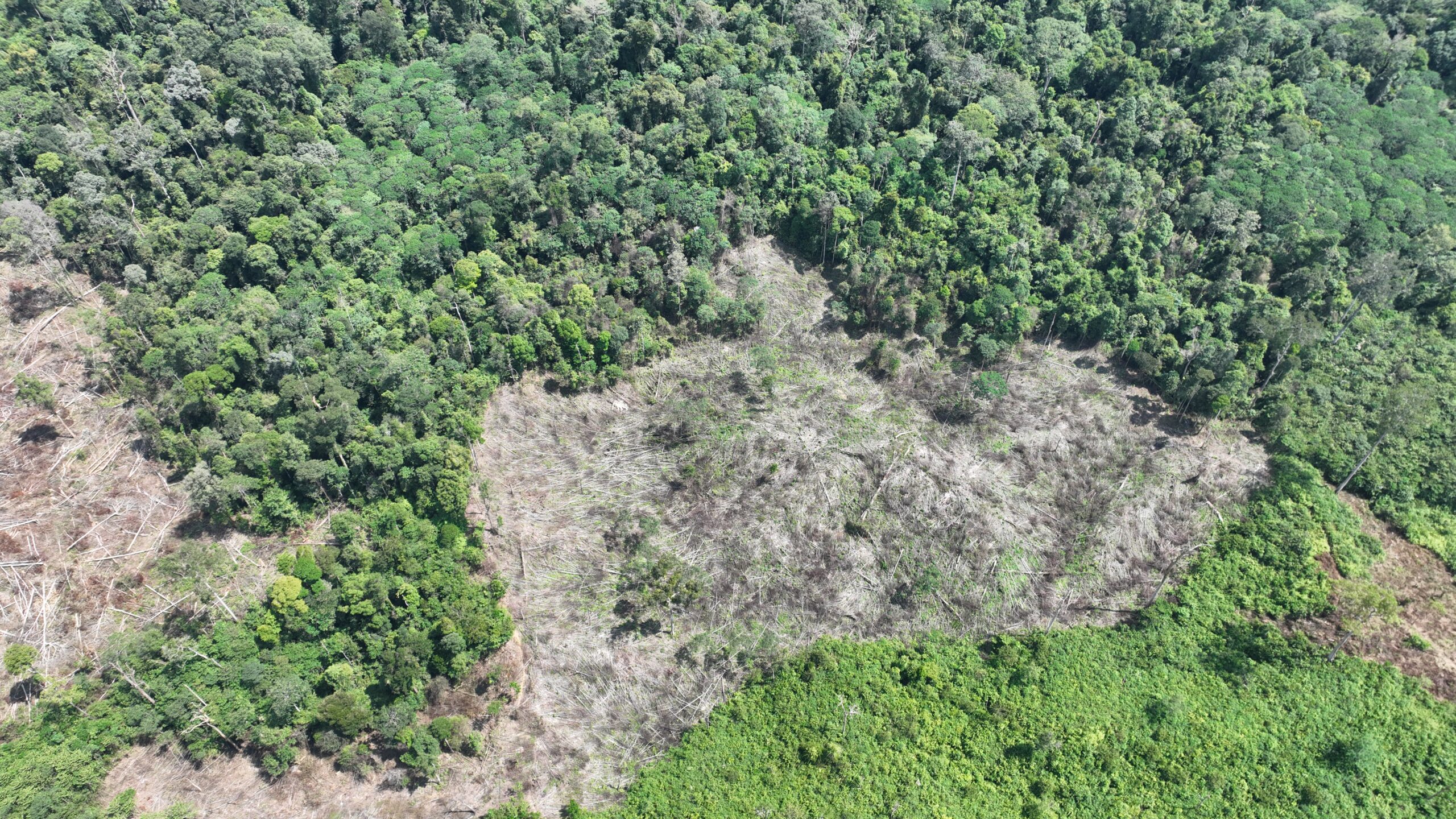
Deforestation by Mr. Jumady to clear lands for palm oil plantations GPS Coordinates 03°57’05.66″N 98°00’18.62″E
These cases show that, despite some progress made to reduce deforestation inside concessions in the Leuser Ecosystem, even the last remaining, critically important forests inside protected areas of the Gunung Leuser National Park have not been adequately shielded from illegal logging and Conflict Palm Oil expansion. These world heritage areas are globally important elements of Indonesia’s extraordinary natural heritage, and once destroyed they can never be recovered. To keep these irreplaceable forests standing, much more effort is needed by major brands and their suppliers to stem forest destruction by local elites outside concessions, including within Aceh’s most important protected areas.